VACANT LAND PICS NEEDED JUNE CREEK, AK $400 (CLEAR, AK)
‹image 1 of 2›
compensation:$400
QR Code Link to This Post
678-673-9683
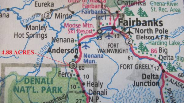
I have a job for someone to take pictures of 4.8 acres of vacant land in June Creek, AK.
The best route appears to be 1.25 miles off of Parks Hwy (Hwy 3). Look this up on Google Earth before you go.
The area just suffered a forest fire.
It starts off as a good road then narrows to almost a trail. You will have to walk part of the way.
Call me first before leaving so we can discuss this. 678-673-9683
You will need a hand held gps device in order to take the job. Google maps from a cell phone won't work. You'll need this to find the way in and the corners.
Take pictures of the stakes and mushroom head with numbers on it. Also take a 360 video of each corner and the road in. The DNR does a real good job of marking the corners with a large mushroom head on the rebar stake with numbers; most of the time the trees are cut around the stakes.
Take the pics, download them to a thumb drive and mail it to me. I will pay for the thumb drive and mailing in addition. Label the pics and take pics of the stakes. Take pictures and videos of the corners, the land, interesting features and the roads going in.
Once I receive the thumb drive I will send the money through Venmo, Zelle, Cash app or personal check. I have hired people for years to do this type of work. Drone pics do me no good since it's all forest.
These pics are selling pics so they must be the best quality possible. Take your time, be creative. I'm posting these pics online to sell the property.
Look at the map posted. In the google earth photo, I made a white line showing the best way.
The gps coordinates are below:
Entrance off of Parks Hwy are:
64.134066, -149.254916
The coordinates for the last turn going south on the map are:
64.128074, -149.278129
NW corner: 64.121598, -149.276508
NE corner: 64.122200, -149.273600
SE corner: 64.120700, -149.275400
SW corner: 64.121000, -149.272400